Sun 25th Jan, 2015
Holme Moss & Isle of Skye Walk
Members: James Meakin, Lester Payne, Andy Stratford, Sandy Gregson, Jim Gregson
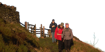
Winter had properly arrived ten days before the meet, cloaking the moors and closing the roads. Luckily the tarmac was uncovered as the snows relented leaving the hills under a white blanket, but across the tops there was a biting cold wind and a promise of sunshine.
Quickly we left the cars and sped over to the trig point on Black Hill - nowadays surely the greatest misnomer in the Dark Peak? We skidded and skipped down the Pennine Way flagstones and up to the Isle of Skye. Declining the wares of the tea wagon, surprisingly in situ and open for business, we strode down valley towards the reservoirs, dropping out of the wind and enjoying the warmth from the sun.
Jolly conversations livened our passage by Bilberry Reservoir, and shortly after we enjoyed a decent lunch stop before making a jink through Holme village. On the way above more reservoirs to gain entry into Ramsden Clough, we crossed tracks with a bunch of 4-wheel drive enthusiasts busily churning and tearing up the bridleway, displaying their essential 3 "F"s --
Fat wallets, Fat arses and Fat heads.
The sun by now had given way to cloud and after climbing to the head of Ruddle Clough, first drizzle then light rain persuaded us not to linger as we ploughed through deeper snow back to the Holme Moss road and the cars for a quick change out of the wind, and away home.
A good walk enjoyed by a small but keen group.
Jim Gregson
Meet Promo:
STOP PRESS - CONTINGENCY PLAN FOR SUNDAY 25th
Ref Sunday 25 January 2015 HOLME MOSS and ISLE OF SKYE WALK
Meet Leader Jim Gregson advises ---- The Holme Moss road has been closed in the last day or two because of snow and ice from last weekend, so the start point for the walk may not be reachable by road if still closed by next Sunday. Weather is expected to stay cold for rest of week. Please check on AA Roadwatch 84322 or www.aaroadwatch.co.uk . You could also check with the meet leader by phone on 0161 969 8233 - but NOT after 9:00pm on Saturday. If the road is still closed, alternative start for the walk will be the Crowden carpark at Grid Ref SK073993 at the same time viz. meet at 0915 for prompt start at 0930. If the start is from Crowden, thewalk will be a bit longer, of course, as it will approach Black Hill by going up the valley past Laddow Rocks and towards the end may finish down Tooleyshaw Moor and Westend Moss to Crowden.
ORIGINAL INSTRUCTIONS BELOW HERE
Note (for younger readers) - this is a Peak District walk, not a long distance trek to the Hebrides. A very good opportunity to be walking off some of your Christmas/NewYear sloth.
Meeting/Start Point : Holme Moss summit carpark at Grid Ref SE096037, precisely on the Derbyshire-Yorkshire boundary, within sight of the TV transmitter station - fog permitting. For most people this will best be accessed via the A628 Crowden-Woodhead road then up the A6024. Meet at 0915 for very punctual start at 0930 (January days are short! Bring headtorch.)
Route : From carpark, over stile then head NW crossing Holme Moss to round Heyden Head then WSW to arrive at Black Hill trig point. No real path for this section, but nowadays not the black morass of peat slutch it used to be. From Black Hill follow flagstoned Pennine Way NE descending to Black Dike then NNW crossing Dean Clough and up to A635 road at Wessenden Head. Turn R for 100m where at Grid Ref SE076073 there is sometimes a tea waggon (unlikely in January). Just over the wall here is a small overgrown enclosure with small stone remnants of what historically was the Isle of Skye Inn.
Just a few metres past this the path of Kirklees Way leaves the road (ladder), going downhill SE, then generally E overlooking Marsden Clough. Enter walled Nether Lane at fork, going past Goodbent Lodge, Bartin and Greaves Head. Many small farms in this section were compulsorily closed down as they were in catchment areas for water supply reservoirs built further downstream. At Grid Ref SE099074 turn sharp R then follow track to a point directlyabove the dam of small Bilberry Reservoir. (In 1852 the original dam here collapsed and the subsequent flood killed 81 people and sweptaway four mills and dozens of other buildings towards Holmfirth) Descend to dam by two hairpin bends, cross over, then follow Kirklees Way curving through fields to Holme village. Go R at road fork to take track going down by Brownhill Reservoir to cross the dam between lower and upper reservoirs then go up onto minor road. Turn R and just by carpark entrance take path uphill to L and follow round above Riding Wood, bearing R.
Continue on track by edge of wood now going SSE heading towards Ramsden Clough. Thread through old quarry workings at Grid Ref SE123044 and continue on this line (no path marked on map) for c.300m to where Ruddle Clough drops in from E. Go L on grass up to head of Ruddle Clough where a fence is met. Take path R by fence contouring the upper rim of Ramsden Clough. This path continues and crosses heads of Little and Great Twizle Cloughs, then heads W below Lightens Edge until,a final gentle climb leads into the carpark lying on NE side of Holme Moss road at Grid Ref SE098039. From there 400m of uphill tarmac leads back to the day's start point.
Total distance - approx.20km, so a steady pace should see completion in daylight.
Maps : OS Explorer OL1 Dark Peak and/or BMC Mountain Map Dark Peak.
All welcome. Live dangerously! - most of the day you will be in West Yorkshire.
Jim Gregson


