Greenland Expedition 2005.
|
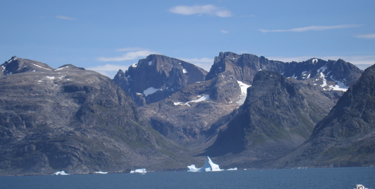
Tornarssuk (1230m) from the sea.
View from the sea up towards 1230m, right of centre of picture. Valhalla (1388m) is to its left. A ridge system extends a long way south on the skyline to 1120m. The long flat valley heading left has a steep head which was not explored. 1090m is on the far left.
Go back to image map or image list.
Photo: D. Bone.
|


