Sun 20th Sep, 1998
Yorkshire Dales Walk
Members present:Margaret Baldock, Linda Crossley, John Dobson, Jim Gregson, Sandy Gregson, Bob. Haynes, Alan (L) Jones, Iain McCallum, Neville McMillan, Tony Marsh, Lorna Marsland, Lester Payne, Alan Peck, Derek Seddon, Brian Taylor, Chris. Thickett, Peter Walker, Frank Willliams, Keith Williams, Alan Wylie, Dave Wylie (22)
Guests present : Christine Beeston, Mike Graves, Sylvia Haynes, Dudley Moore (4)
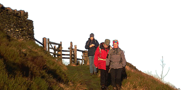
A glorious sunny day. A great crowd keen to get onto the hill but where was Dudley Moore? After some delay we all set off down Twistleton Lane before ascending the end of the ridge at Scar End. The going underfoot was very good and soon we were bounding along the ridge leading to Whernside. Around 11am. we stopped to refuel and to admire the fine views over the hills. Continuing along the ridge we reached the summit of Whernside (736m) where we stopped for lunch. The views from the top were superb - Pen y Ghent, Ingleborough, Aye Gill Pike and the Howgills. The descent down to the road at the head of Kingsdale was swift. Neville passed us on the way up! He had arrived late and drove up Kingsdale to catch up with the meet. The track from the Dentdale road proved extremely wet but it was a lot better than the fell - the aptly named Foul Moss. From the track a fairly steep climb up the fell side brought us to the top of Greenhill (626m). A stop for a breather allowed everyone to catch up. By this time many members were feeling very thirsty but nobody attempted to slake their thirst in the many pools of rather stagnant water scattered along the ridge leading up to Gragareth (627m). Neville caught us up at the summit.
At Jim's suggestion we descended into Kingsdale to visit Yordas Cave instead of continuing along the ridge as planned. The many springs on the way down allowed everyone to quench their thirst. Yordas cave has a very large chamber (55m long, 1 5m wide and 20m high). Inside a waterfall could be heard in a nearby chamber. From here we made our way back up the hillside to join the Turbary Road - an old medieval track running along Kingsdale. The Dale is riddled with pot holes. There were many close to the Road. The shaft at the western end of Rowton Pot drops 200 feet - there are no safety rails and yet it is only a few yards from the Road! Would the landowner be liable for any injury to a visitor/trespasser?
Towards the end of the Road we met Bob and Sylvia Haynes who had followed the original route down from Gargareth. Dudley joined us at the cars. He had arrived late and had followed us round the circuit. A visit to the pub in Thornton with its fine selection of special beers and many malt whiskies completed the day. (Distance 13/14 miles)
Thanks for your support.
Iain McCallum
Meet Promo:
This walk climbs Whernside along the length of its ridge then drops down to the road at Kingsdale Head. It returns over Green Hill and Gragareth. It can easily be extended to take in Great Coum and Crag hill or shortened to just climbing Whernside.
Start/finish: Twistleton Lane, Kingsdale at the junction with the Thornton to Dent road (GR. 692760) - NB. NOT INGLETON AS STATED IN PREVIOUS NEWSLETTER Parking at this point is rather limited but it is possible to park alongside the road before reaching Twistleton Lane at GR. 691758 - in or near a lay-by opposite a small quarry.
Route: Twistleton Lane - Scar End - North Green - West Fell - Bruntscar - Whernside(736m) - High Moss - Foul Moss - Greenhill(626m) - Gragareth(627m) - Dodson's Hill - Turbary Road - Twistleton Lane. Distance 12 miles
Meet at 9.15am for a 9.30am start. Map:O.S. Outdoor Leisure 2 Yorkshire Dales - Western Area.
Iain McCallum


