Sun 19th Feb, 2006
North Pennine Eye - Opener
Supported by: James Hartley, John Castick, Virginia Castick, Sandy Gregson & Jim Gregson.
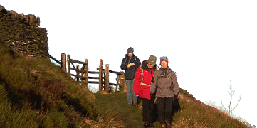
This excellent walk went exactly to plan despite a slightly fog-affected approach drive.
James was introduced to some of the best landscape in the true North of England and Virginia wore rather more clothing layers than the temperature really demanded at times. True, there was a short interlude when snow actually fell - note for younger readers: this is what in English is called 'winter'. The shooting cabin provided a bracing spot for lunch before the walk via Maize Beck to High Cup Nick. By the time we got there, the sun was shining brightly and we could fully appreciate the great views across to the Yorkshire Dales, the Howgill Fells and the snow-decked Lake District mountains. A slippery descent into High Cup then led us comfortably down, and thence back to Dufton. Convivial company and varied conversation helped to make for a very enjoyable day out.
Jim Gregson
Meet Promo:
This winter walk will attempt to provide a close encounter with the superb landscape feature of High Cup Gill, weather and conditions permitting, with a start and finish in Dufton. Nesh southerners aka Mancunians, please note, this will be in the real north of England so it will probably be very cold and even feet-deep in snow.
START POINT: Carpark in Dufton (behind the public bogs) Grid Ref. NY 689 250 MEETING TIME: 0915 for very prompt start at 0930 - this is February!
ROUTE: Leave Dufton northwards on Pennine Way/Hurning Lane bearing NE up Green Fell to reach Knock Old Man then the broad top of The Heights/Knock Fell. (Optional extension from here for the very fit/very keen - remember it's February and will add 4+ kilometres - go NW to top of Great Dun Fell and back, passing and repassing Dunfell Hush, relic of the mining industry). From the Heights head SE towards Great Rundale Tarn, on rougher ground, aiming to find the shooting box (corrug. tin roof) at Grid ref 728 283 - suitable spot for lunch stop (or death if desperate). If sill alive skirt N shore of Tarn to pick up and follow course of Tarn Sike/Maize Beck to footbridge at Grid ref 749270. Go SSW across High Cup Plain to High Cup Nick - this is the "eye-opener", spectacular view, fingers-crossed, South through High Cup. Choose correct steep gully in far NE corner to descend via bouldery scramble into the head of High Cup then follow floor of canyon all the way SW to join farm track at Grid ref 724235 to reach minor road beyond Harbour Flatt. Finish along road back to Dufton with possible variation along track past Town Head to Pennine Way near to Bow Hall thence into Dufton. NB - in case of severe weather/thick fog/deep snow it may be advisable to return by the Pennine Way all the way from High Cup Nick along a pleasant terrace without the descent of the Gill itself.
DISTANCE: Yes
TIME: Personal Best
This route is also suitable for runners so any member of that persuation is cordially invited to travel it at speed. TRAVEL TO DUFTON: from Manchester area by M61, M6 to Penrith Junction 40, then A66 towards Appleby - slip road for Dufton just after going under railway bridge, then R at T-junction and uphill on minor road into Dufton. Suggest leave Manchester no later than 0700. All welcome, old, young, new members, prospective members, E9 leaders et al.
MAPS: OS Landranger 91, Explorer Map OL19 Howgill Fells; Old Style Yellow Cover OL31 Teesdale.
Jim Gregson


