Sun 11th Mar, 2007
Forest of Trawden Walk
Members: Mark Ashley, Virginia Castick, Lester Payne, Alan Peck, Phil Ramsbottom, Dave Shotton, Frank and Margaret Williams, Keith Williams; Alan 'Liverpool' Jones also gets a tick for an appearance late in the day!
Guest: Nicoletta Bobola
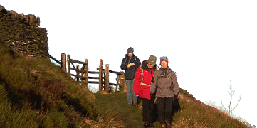
A keen group of walkers made a prompt 10.00 a.m. start from the Trawden Road car park near Wycoller on a fine sunny day, albeit one with a chill March wind. A pleasant meander through Wycoller village led past a photogenic packhorse bridge and ford, and an antique clapper bridge made of several stone slabs. Some time was spent inspecting the ruins of Wycoller Hall with its staircase to a now-vanished first floor and its grand fireplace with curious adjacent 'keyhole' niche; Frank Williams was also very interested in the aisled barn conversion further along. A little way past the duck pond we turned off across the ancient single-slab clam bridge and headed uphill towards Bank House and then on towards the more rugged uplands of the Forest of Trawden.
Slightly off track over rough tussocky grassland on Flake Hill Moor, we finally joined the Pendle Way by the head of Turnhole Clough, thanks to the local knowledge of Keith Williams. Following the Pendle Way along Saucer Hill Clough, we decided not to cut straight up over rough country towards the Great Saucer Stones, but continued until we could follow an easier path past a small reservoir straight up Boulsworth Hill to the Weather Stones (pre-lunch food stop) and then on to the summit at Lad Law, complete with 20-foot radio aerial and operator. Frank, Margaret and Virginia had dropped behind and later turned back from this point down over Abbot Stone and then back across fields past Germany Farm to Wycoller, where the rest of the party caught up with them at the end of the day.
From Lad Law we (the larger group) cut across the moor to Warcock Hill, and then followed a vague ridge SW, stopping off to investigate the interesting-looking slabs and pinnacle of the Dove Stones grit outcrop. The path finally petered out and we made our way across boggy grassland to Grey Stone Hill, giving a fine view over Widcop Reservoir. Here we sheltered from the wind in the boulders and had lunch, disturbed only by some off-road motorcycle scramblers in the vicinity.
We then retraced our path (a slightly unsatisfactory bit of route-planning, but difficult to avoid) for about 20 minutes via Dove Stones and Warcock Hill, and then headed towards Crow Hill, something over a mile and a half away. The route started along a vague dyke, continued over some boggy ground crossed here and there by 4WD tracks (presumably because it's maintained as grouse country), and the group then made a beeline across a pathless sea of heather (though parallel to a line of occasional boundary markers), requiring negotiation of one or two deep groughs.
From Crow Hill, the path led down Nan Hole Clough past grouse butts and a shuttered shooting lodge. Further down we joined the Brontë Way briefly, where we were met by Alan 'L' Jones ascending from the opposite direction, fresh from supporting a NW Ski Federation event.
We descended towards Wycoller via Smithy Clough (though I don't think we ever decided if our particular route here was the Brontë Way or the Pendle Way, or both). We reached Wycoller village a little after 4 p.m., where we rejoined Frank, Margaret and Virginia. Some of us had a look at the willow sculptures of animals by the village, and stopped at the café for alfresco tea and in extreme cases, scones and jam, before departing for home.
It was reported that at least one member of the group (Margaret) was dreaming about walking over tussocks and disappearing into a hole in the ground that night!
DaveS
Meet Promo:
In a last-minute addition to fill a gap in the meet calendar, I have opted for a walk in the less well-known Forest of Trawden (to the NE of Burnley, and the SE of Colne). The walk starts near the small village of Wycoller, proceeds through picturesque Wycoller Country Park, and then explores the high moorland of the Forest of Trawden before descending back to Wycoller. Parts of the Forest of Trawden have only been opened up relatively recently as public access land under CRoW legislation, and the going can be expected to be somewhat rough and trackless in places. Tops include Boulsworth Hill and (in view of the access law) the fittingly named Crow Hill.
Start point: Free car park near Wycoller at grid reference SD926395 - there are two car parks near Wycoller, this is the one on the west side of Wycoller on the Trawden road (not the one to the east on the Haworth road). Approach from the Trawden side. There is (generally) no vehicle access to Wycoller village itself.
Start time: Meet from 9.30-ish for a 10:00 a.m. start.
Map: OS Explorer OL21 (South Pennines), alternatively Landranger 103 (Blackburn, Burnley & surrounding area).
Distance: 12 miles or thereabouts.
Route: Car park - Wycoller village - follow Wycoller Beck through Wycoller Country Park - turn right near the clam (ancient single-slab) bridge and ascend Turnhole Clough - turn right onto the Pendle Way - Saucer Hill Clough - uphill to the Great Saucer Stones and continue up Boulsworth Hill to the Weather Stones and the summit at Lad Law (trig point) - Warcock/Peacock Hill then SW via Dove Stones to Grey Stone Hill (overlooking the Widdop Reservoir) - retrace path back via Dove Stones and Warcock Hill and continue NE to Crow Hill - then descend NNW by Nan Hole Clough and Dove Stones Moor (named after a different set of Dove Stones from the earlier ones) - turn left onto the Brontë Way briefly, then right along the Pendle Way heading down Smithy Clough in the direction of Wycoller - follow the beck again through Wycoller Country Park (tea shop if desired) - Wycoller village - car park.
DaveS


