Sun 1st Feb, 2009
Peak District Walk
Members: John Castick, Virginia Castick, Trish Cranston, Andy Croughton, Roger Dyke, James Hoyle, Kasia Hoyle, Bob Kelly, Iain McCallum, Neville McMillan, Dave Shotton, Brian Street, Brian Taylor, Frank Williams.
Guests: Rachael Flynn, Katy Perreault, Jeff Richardson, Liz Wilson.
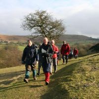
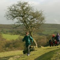
A grand total of eighteen keen walkers gathered at Gradbach car park and set off around 10 a.m. in fine weather past the Youth Hostel to follow a path through woodland above the River Dane leading to Danebridge. There we resisted the lure of the local pub (much to Andy's disgust) and climbed up steeply through woodland, pausing for elevenses just before we reached open fields at the top. We then walked across the fields past Hangingstone Farm and followed the track passing below the Hanging Stones. (We didn't detour to visit these although some of us were curious about a plaque distantly visible on the rocks; this, I later discovered, is a memorial to local member of the gentry and military man Lt Col Henry Courtney Brocklehurst, killed in Burma in WW2 - though it doesn't mention his responsibility for the wallabies which once roamed the Roaches after escaping from his private zoo!). We continued in somewhat duller and breezier weather towards the intersection with the road at Roach End, where John Castick and Frank Williams left us for a shorter route back to the start point.
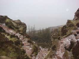
The rest of the party carried on along the ridge taking us above the Roaches, by which time a fine, dry snow was beginning to fall. Temperatures must have been low recently as Doxey Pool was frozen over when we passed. We continued down the ridge in driving snow to the saddle between the Roaches and Hen Cloud, and followed tracks past Well Farm in the general direction of Naychurch. At this point the meet leader got decidedly lost and a detour ensued along a lane taking us above Dains Mill in the direction of Upper Hulme; the route was finally retraced and we continued through the farm at Naychurch. The snow had stopped falling by this time so we stopped for a late lunch in the lee of a rocky outcrop next to a bend in the minor road just west of Ramshaw Rocks. At this point John Castick suddenly reappeared in his trekking sandals having driven to find us and collect his passengers.
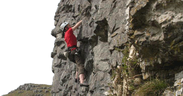
Lunch eaten, Virginia, Roger and Neville accepted John's offer of a lift and made an early exit, although not until Roger and Neville had led us on a short excursion to the southern end of Ramshaw Rocks to point out a noteworthy climb they had done a few years before. After failing on a VS on the Roaches, and even deciding against doing the Moderate escape route, they had retreated to Ramshaw Rocks where they had surprised themselves by succeeding in climbing a short but fierce corner groove which goes at E1! Roger subsequently identified the route as Louie Groove, described in my Staffordshire Gritstone guide as "an intimidating lead". [Strongly attacked by the KMC during Foot and Mouth. Ed.]
 |
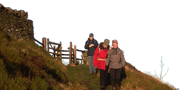
| Over the Roaches ridge |
Now down by five, the remaining stalwarts continued north along the ridge of Ramshaw Rocks, down across fields of heather and long grass, crossed the road and continued north on a track past the crags of Baldstones. Paths led on over rocky ground a little way to the right of Gib Torr Rocks and on through a deforested area just before we reached the road by Gib Torr Farm.
From here the way headed west on the home stretch towards Gradbach along the road and a subsequent track which contoured around the lower slopes of Gradbach Hill. A fine snow had started to fall again, driven by wind and starting to settle on the ground.
We passed the Youth Hostel a little before 4 p.m. (unfortunately not leaving time to avail ourselves of their public weekend café which was closing at that time) and regained the car park shortly afterwards. Total distance covered by the main group in the day should have been around 12 miles, although the detour near Hen Cloud probably made it nearer 13!
As twilight approached, around 10 of us repaired to the Traveller's Rest on the A53 near Flash for coffee or something stronger (and chocolate Freddo Frogs), before heading home through the snow.
DaveS
Meet Promo:
This is a pleasant winter walk taking in some familiar Staffordshire gritstone climbing country, along with some lesser-known territory in the form of a wooded gorge and some open moorland.
Start point: Gradbach car park and picnic area at grid reference SJ998662 on the road to Gradbach Youth Hostel (approach from the A53 via Flash, or from the A54 at Allgreave). The car park is apparently free, but is relatively small so please share cars where possible.
Start time: Meet at 09:45 for a 10:00 start.
Map: OS Explorer OL24 White Peak Area; alternatively Landrangers 118 (Stoke-on-Trent & Macclesfield) and 119 (Buxton & Matlock).
Distance: 12 miles or thereabouts. Bring a headtorch just in case.
Route: From Gradbach car park, head towards the Youth Hostel then take the path to the right of it. Keeping the River Dane on your right, follow the woodland path down the river gorge, crossing a footbridge over Black Brook and continuing along the Dane Valley Way towards Danebridge.
Just before the bridge at Danebridge, turn left at a stile and follow signs to Hangingstone, climbing through woodland and continuing across fields and on tracks above Hangingstone Farm and below the Hanging Stones.
Follow the ridge to Roach End and on past the Roaches, keeping as high as possible above the crags along the way. Carry on and descend the ridge, passing to the right of Well Farm and skirting around the north side of Hen Cloud. Follow paths and tracks past Naychurch to the A53, then turn left and follow the ridge of Ramshaw Rocks.
Heading north from Ramshaw Rocks, descend across heathery moorland towards a lane junction, then cross the road and follow paths across rocky ground and through the bog- and woodland of Black Brook Nature Reserve. Turn left to join the road near the farm at Gib Torr, and after a short distance turn left again at a T-junction. Follow this road trending downhill towards Gradbach, continuing straight on at a junction to follow a walled track heading in the same general direction. Continue along paths below Gradbach Hill, then keep on along a track and finally a lane leading back to the car park.
DaveS
