Sun 22nd Nov, 2009
Bowland Walk
In the pre-write up for the walk, I said there will not be many people walking in this area, how true this was!!!!
Only the very hardy turned out, Iain McCallum, Bob Kelly and I, that was it!
The previous evening I phoned Pat Holt for the latest conditions in that area. It seems her son and grandson were up to their waists in water, and this was on ordinary fields!!! We had to cross two streams twice; Pat suggested that I should forget this option and cut the walk short.
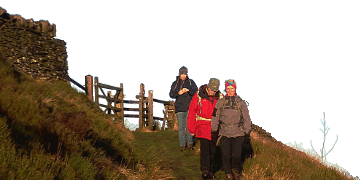
The rain was quite heavy when we started our wet, squelchy tramp. Passing Blindhurst Fell the rain stopped, and on the long pull up to Fiendsdale Head, the sun popped out for a short time. The views were great, Blackpool Tower was quite visible! From this point we started the trudge onto Fairsnape Fell, it was quite hard going, you thought your boots were being sucked off.
Lunch was taken at that well known eating establishment called Paddy's Pole, it was here the rain and wind hit us, it was so bad I did not need to shave that night; my face was very smooth on one side. Iain set a cracking pace on the descent, just after 14.45 we were back at the cars. The shortened walk was 8.12 miles with 1,600 ft of ascent, but it seemed a lot further than that. I must remind myself to avoid this area in the wet. [Make that the whole of the UK, Ed.]
Michael Graves
Meet Promo:
This is a delightful walk, great scenery, and not too many people around.
The walk will start at 09.45 sharp! Starting from Fell Foot grid ref: SD601443. The walk continues low level, passing Blindhurst, Higher Fair Snape and on to Holme House.
From here we climb up to Fiensdale Head. The path now descends, following Fiensdale Water, to Langden Castle G.R. SD605503.
From Langden Castle we may have a paddle as we have to cross two streams! Our route now continues up Bleasdale Water, as we climb out of the gully we turn west and follow the path for a short distance. We take a path down Saddle Fell, to Saddle End, and continue going south west to Wolfen Hall, and back to our cars.
Total distance about 11 miles.
Directions from Manchester to the start point
Take the M60 north onto the M61, then M6 and come off at junction 31a. Follow signs for Longridge - B6243.
There are about 3 traffic islands soon after coming off the Motorway, just follow B6243 Longridge. After about 3-4 miles, as you approach Longridge, there is a mini-roundabout at the Old Oak Pub. Bear left for Longridge and Chipping, then carry on to the next roundabout. Carry straight on and at the next round about bear left, following the main road for Chipping, etc.
Just before Chipping you cross a bridge. After a couple of hundred yards, turn right - signed Chipping. As you enter Chipping (narrow) roads, turn left at junction, then right at the church. Carry on for about 300 yds and take the left fork. Continue ahead for approximately ¾ mile. At the next Y junction, bear left - this is called Fish Lane. After another 400yds turn right, and carry on to the next road junction and park here.
Michael Graves


