Sun 13th Mar, 2011
Stanton Moor (Whitish Peak)
Members present: Dave Shotton, Iain McCallum, Mark Ashley, Laura Collier, Bob Kelly, John Castick, Virginia Castick, Ding Koy, Dave Wylie, Dave Bone.
Guests: Sandra Rice, Wayne Rice.
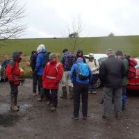
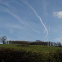
A wet drive out was not promising, though the forecast was good. The layby had been cleared since my previous visit – just as well, as more and more cars turned up close to the wire – differing timekeepers might just excuse John & Midge, though we then had to sort out a rendezvous for John to do a shortened version. However, the air had all but dried up then as the large group marched the short distance along the road to turn into the fields for the start of the walk.
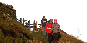
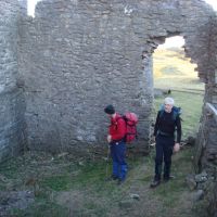
Down into Lathkill dale, a mile west then steeply up the stone stairs out of Cales Dale – the main climb of the day pulled the group out. Easily across the high ground with brightening skies and descended towards Bradford dale. Typical of the White Peak, the glutinous mud on polished rock forced a gingerly descent, or a bumpy descent in the case of Midge who ended up nicely camouflaged in mud. Close to the river we passed the old building, now 2 walls less than a couple of years ago – not long to go for it, and then the bridge provided an excellent late elevenses stop. Or a laundry session.
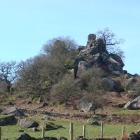
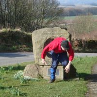
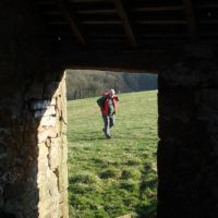
By now the weather forecast had proved its accuracy and we were in warm sunshine for the rest of the day. We met John waiting on a bench beside the river and then tried to leave – Youlgreave’s river swimming pool was looking very attractive to one in particular. A bit of decisive leading from the front got us on the way – no sound of a splash behind us, perhaps because a wave of mud would spoil the clean pool, and spoil the idea of the mud dusting off. On southwards, to a long lunch break among the boulders of the tor of Robin Hood’s stride. Hard to leave but we had to cross the road to gain Birchover, very strung out by this stage. An odd “polo mint” engraved stone was obviously seen as a doorway from one world to the next by some.
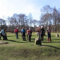
Another quick road march round the outskirts of the Stanton quarries was accompanied by Mark sharing another of his interests – that of squeezing through small orifices. Strangely he seemed to find like minded souls. Now the way led onto the raison d’etre of the walk, Stanton Moor itself, over a stile, with a lifting dog gate. At which, terrier Ashley’s eyes lit up and he rushed for the open aperture, and was through, tail wagging (It did occur to me that the gate could make an excellent execution device…). From here it was a pleasant wander past the interpretation boards and 4000 years of history, to regroup again at the stone circle. The figures on this interpretation board did look a little spectral, but nothing visibly happened to the group when the KMC were all within the stone circle. No alien motherships… very dull.
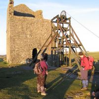
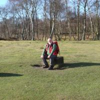
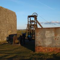
By road and field we returned to Alport for another long laze at the foot of a wall – I checked over the fence, yes, we were actually below river level. On our way again, losing the Casticks before the pull up the hillside to Over Haddon. A complicated way through the fields (sorry for the wall hopping at one point) led back to the main road and decision point. Bob and Iain electing for the direct return to the cars, and the rest following me round the back of the hill heading for Magpie Mine – very Cornish it looked from a distance too. A little time was spent wandering about the substantial buildings in the lowering sun and gauging the depth of water in the mineshaft. Then it was a last gasp along the roads to the cars before dark and an end to a fine day. Thanks to those who came and well done those who made it to the bitter end.
Dave Bone
Meet Promo:
For this walk we’ll head to the Peak District south of Bakewell, the area is packed with interesting features, with Stanton Moor having a collection. Only a tiny moor, so the walk has to get there to give a sense of achievement, via a ‘whirlwind’ tour of dales and country. But watch out for the mineshafts. The start point isn’t ideal, but…
Start point: rough layby on the N side of the B5055, A515 – Monyash-Bakewell road at SK183670 (hopefully it won’t be full of a mountain of ice, gravel, truck or something else). If coming from Buxton on the A515, just over 2mi (3km) E of Monyash, it is 150m past the fork to Over Haddon. Please share transport as much as possible. Walk starts at 10am.
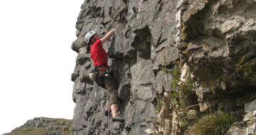
Route: Head W on the road for 350m, head S into the fields. At this point crossing the head of Mandale Rake described in 1585 as having the “beste orre in the peke”, though the best mine remains are down towards Lathkill dale. A Rake in the Peak context being a linear ore vein often worked on the surface, and sometimes detectable in the contours – there are quite a few on the OS map (and a mining map shows the amazing number in this quarter of the Peak). Descend into Lathkill dale, turn R up dale, then up the steep rocky steps to Calling Low (we’re now on the Limestone way). Out to the road and through the car park, mine workings all around. We’re crossing Long Rake (7miles long), further W are Flourspar & calcite mine workings (the huge open cut and underground workings closed in 1981 but the processing plant is still running). We descend to the River Bradford, and head downstream to Bradford itself. Those preferring a short walk can follow the river down to Alport, the rest turn R heading for Harthill Moor, thence the gap between Robin Hood’s stride, and Cratcliffe Tor (1 of 2 climbing areas on the walk).
Through Birchover and onto Stanton Moor itself. Chosen as a centre by the Bronze Age inhabitants of the area, the moor contains at least 70 barrows as well as stone circles, ancient enclosures and standing stones. However, don't go expecting anything on the scale of Stonehenge, most of the monuments and remains are very small-scale and overgrown with heather. We head for the “Nine Ladies” Stone circle - actually 10 stones, a buried slab was discovered in 1979 to the east of the circle. In keeping with many Derbyshire circles none of the stones are particularly tall and this ring has a diameter of about 10 metres. 35m SW of the circle is the 'King Stone' a single 19thC graffiti covered stone (things don’t change over the years) that is now known to have formed part of a destroyed ring cairn. It was once taller but was damaged after being hit by a vehicle (things still don’t change). OK, by now you’ll have decided who you want to sacrifice (we do ‘lose’ people on walks on occasion!), but the meet leader won’t be eligible – you’re now at the most distant point of the walk and the cars are… well that’d be telling.
Now through Alport near to Rheinstor, Conksbury bridge, and rise above the Lathkill to head through the “back streets” of Over Haddon. Cut across fields to the B5055. You could head back to the cars, but for a couple of miles more we can visit another item of interest and perhaps get some good pictures against the setting sun. Around the back of Bole hill we go, passing Magshaw mine, then west into the Magpie mine complex. Mines were often imaginatively named, this area included “Dirty Red Soil”, “Great Red Soil”, “Maypit” and “Horsesteps”. The mine had Cornish connections and was finally closed in 1958. Many surface remains still survive, often to near their full height including the Cornish design engine house. Researching the map has revealing a huge number of interesting details and I’ll certainly look on the White Peak with new eyes. There won’t be much light for them now so it’s S for the road, Green Lane and the cars.
Total distance, inc. Magpie, ~22km (13.5mi). Hope you’ll join me!
Dave Bone
