Sun 23rd Oct, 2011
Wharfedale Walk
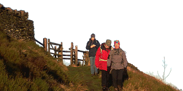
Members present: Dave Bone, Dave Wylie, Dave Shotton, Bob Kelly, Ding Koi, Kate Harvey, Alan (H) Jones (back from 22°C in Slovenia) and Skip.
The entire meet gathered in Linton, just in time under grey but mild & dry skies, with a forecast of blue skies and 18°C by afternoon. Off we set, narrowly avoiding being dragged in for Sunday Service at Linton Church to hit the first problem – ¼ of the stepping stones were underwater and the rest were a touch slippery. Skip wasn’t too happy with this so discretion etc. and a back track for the bridge, only an extra ½ mile or so. The mile or so into Hebden was typical Dales walking, amid tales from Slovenia, through ever narrowing squeeze stiles that gave even Ding problems. Quickly urging the party past the pub with the open door, we entered mining country via Hebden Beck. The sky alternately darkened and tantalisingly brightened, even a pocket of sunlight but the increasing wind brought in a steady supply of cloud. During this we found out Ding’s interest in squeezing into small holes, the more forbidden by the Water Board the better – and in a mining area there were going to be plenty of holes and shafts! A brisk yomp up the beck and out brought us to the restored Mines Powder House – not quite on the scale of Ty Powdwr, but providing a snack break (at midday), outside because of the smelly resident (dead) sheep.
A pleasant amble up the dry valley on springy rabbit cropped turf followed, with Skip having the least problems with the wire and rusting metal fences, and then into the toughest mile through tussocks and rush, emerging on the Bycliffe track. Now darker than ever - was that a spot of rain or perspiration from the group flying as we sped along to Mossdale Scar and the luncheon boulder. Some macabre discussions from Alan here – this being the site of the tragic 1967 Mossdale Cave disaster (do read http://www.independent.co.uk/news/uk/this-britain/what-lies-beneath-mossdale-caving-disaster-794268.html.). Several could not resist a closer look at the beck vanishing under the brooding Scar, Dave S and Ding vanishing (errk!) for awhile. I wasn’t the only one with a feeling of unease standing in the litter of blocks under the crumbling overhangs.
More swapping of a lighter rucksack between Dave S and Kate, allowing Dave a burst of speed off up the track onto Conistone Moor, Ding exclaiming at the traps set on planks across the ditches. Try explaining the concept of vermin extinction and Grouse shooting rationally! Despite the “Go Back”ing of survivor Grouse, no one took the proffered “turn left for a quick return to Grassington” option. Now actually on the moor we followed landrover and ATV traces (just a few weeks old) past the well maintained shooting butts, until the last traces gave out below the steep rise onto Whernside Pasture. This ground being familiar territory to Alan from his many Fellsman Race runs. Some of us thought Skip showed signs of tiring – not so, Alan! Well, the will or won’t it be clear on top nature of the morning was now decided in favour of no, it isn’t, as we entered the mist – time to regroup before following the fence. A fence isn’t always the best thing in mist – a few minutes past the 695m cairn, 3 of us thought it didn’t feel right, too much descent, so out with old and new, compass and GPS. Yup, heading for Angram so due East for the escarpment edge – only another ¼ mile added to the increasingly impressive total. Hoping that we were going in the right direction, a trail was followed forever, until the summit trig point loomed out of the mist. Break time 10min past ETA!
Follow me! Pointing out the approximate looping curve (round the back of the rush filled hollow) and threading of the maze of water channels route to the footpath on the map, I trotted off. Only 2.5mile to go (Not!), subtracting the GPS record from the 16mile estimate. 15:15 though. Alan though was nearly home, just the quick descent into Grassington – though sorry, we weren’t to follow his perfect race route. Naturally the mist cleared from the top after we left. A winding trail round (or under for Ding) rush patches and across moss, not too wet, with a couple of stream leaps, saw us one by one emerge on the path overlooking Wharfedale with better views. Quick regroup and more speed along to the lonely 512m trig point. “Must collect it, in case it means something” – Bob.
There now followed the most delightful part of the walk, the looping descent to the head of Dib Scar, sadly no sign of a setting sun. However, on the easy stretch of Dales Way into Grassington that remained, the really strong wind in our faces felt positively Saharan. Darkening now, we threaded our way round Grassington, Leader trying to keep members of the group escaping, to return to the Linton Falls bridge. Back on well travelled ground, there was just the sting in the tail sharp ascent back to the cars in Linton. Pretty dark now at 18:20 but still 15°C. Not bad – after the false start I’d estimated 18:30. Even better perhaps as Alan’s GPS produced an Ego boosting 21mile (I don’t believe it) total for the day! Thanks for all those that came and hung on in there to the end – anyone for a Dave Bone “long walk”?
Dave Bone
Meet Promo:
Having warmed up the weekend before, you’ll be ready for a long day. You won’t spend much time “in the dale”, but you will get to appreciate the bulk of Great Whernside, and the amount of mining that’s been hidden away here in the past.
You’ll need OS Landranger 98 at least, and the starting point in the Grassington area is up to you. I shall be starting from Linton (parking for free on the B6265) at 10am (Meet at the bridge near the church, SD 997627). You can use the pay and display Grassington and Linton NP centre carparks and we’ll expect to meet passing the chapel at SE 005632 on the way to the Stepping stones over the Wharfe.
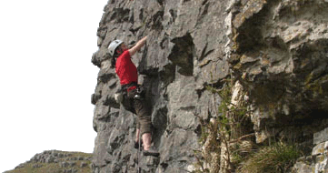
The Route: onwards to Hebden, then N along Hebden beck (lots of mining interest), emerging at the old workings at 019659 where the restored Powder Store is a convenient shelter. Zig-zag north along tracks – intriguing chimneys and buildings to the East (not today, we’ve ground to cover), then follow the ‘dry’ valley continuation North off roading past Gill House, and dodging the plentiful rabbit burrows, to the Bycliffe track, which we follow up Mossdale Beck until the track ends on the moor. We head in a direct(ish) line (thankful it’s not the shooting season) for Whernside pasture (Compass may be needed as the shooting butts aren’t marked on our maps) – ATV track traces help the going at least. Whernside is now our furthest point from home, and from the summit we descend in an arc SSW finding an optimum route through the rushes and dodging the odd resurging beck to pick up a decent footpath giving good views of the dale. This takes us South to the middle of nowhere trig point (512m), from whence there is a delightful descent to the top of Dib Scar (climbing below), and the pleasant, nearly level, Dales Way path back into Grassington which some of us may skirt to the W and S down to the river and the Waterfall & bridge in Linton.
The experienced will note this is a full on “Dave Bone Walk”, circa 16mile circuit from Grassington with ~600m ascent, and the clocks go back the following weekend. Hope to still see plenty of you at the end.
Dave Bone


