Sun 5th Mar, 2000
Howgill's Walk
Members Present: Virginia Castick, Joanne Castick, Linda Crossley, Tony Gask, Graham Harkness, Sue Harkness, Alan (Liverpool) Jones, Paul Johnson, Ian Mc Callum, Brian Taylor, Lester Payne, Pete Walker, Keith Williams, Alan Wylie, Dave Wylie.
Guests: Sarah Mothershaw.
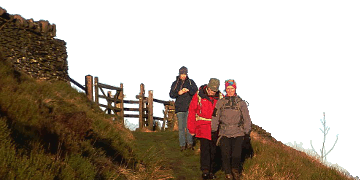
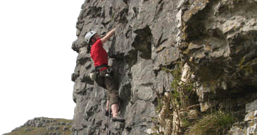
The walk started out with an interesting ascent of Carling Gill, there was even the chance of a sporting bit of scrambling up a rocky spur before we came out towards the top of the gill. Cloud base was down at the start of the walk but as we approached the Calf at 676 metres visibility improved and lovely panoramic views of the lakes and the M6 unfolded! Unfortunately the wind proved to be a wee bit on the strong side, despite this we soldiered on over the Calf and then down towards the river Lune.
Lunch break was taken in the shelter of a sheep pen, a very hygienic place to stop! The second half of the walk was a complete contrast to the first half with a pleasant amble (without the wind) through woodland alongside the river. General feeling at the end of the walk was that it had been a good day out with very interesting varied terrain (that's what the punters told me to my face anyway).
Brian Taylor
Meet Promo:
Meet at 9:30am for 9:45am start. Park cars and meet on side of road just south of where the minor road crosses Carlin Gill (GR 625995 OS map 97, 1:50,000).
Directions to start point - come off the M6 at Tebay (J38), take the A685 south towards Kendal, the road runs parallel to the motorway. Approximately 2 miles south of Tebay take the minor road off to the left (probably signposted Howgill/Sedbergh). This minor road runs underneath the motorway and railway line. Follow this minor road for approximately 1½ miles. As soon as you cross Carlin Gill, park on the right.
The proposed route is about 12 miles taking in some very varied terrain ranging from the hightops of the Howgills to the scenic valley of the River Lune. Initially we will walk/scramble up Carlin Gill crossing numerous small waterfalls on route. A final steep ascent takes us up onto the tops of the Howgills, we then walk as far as the Calf. We then head in a southwesterly direction past Bram Rigg to the hamlet of Bukhaw. From there we cross undulating farmland until we reach the Dales Way. It's then a lovely walk along the Dales Way, which follows the course of the River Lune. The final stretch of the walk is across open heathland alongside a Roman road to where the cars are parked.
Brian Taylor


