Thu 29th Dec, 2011
Pennine Placenames Perambulation
The Pennine Place-names Perambulation was intended to be a sort of consolation prize, to round off the year. Essentially it went from deepest Yorkshire by Baitings Resr. up Grey Stone Height then round to the White House pub, along Blackstone Edge to the M62 and round to Green Withens Resr. and off the Blackwood end of Rishworth Moor.
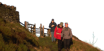
On the day, the weather FORECAST was for showers and dying winds. The ACTUAL WEATHER was atrocious, with gale force winds and more-or-less continuous rain, except when hailstones fell. The KMC team of adventure-seekers thus consisted of 2 Gregsons and 1 McCallum, who duly got battered and jostled, soaked and chilled and arrived at the White House before opening time - but eventually gained entry to dampen the pub seats over pints and coffee. An hour later, traversing Blackstone Edge was "testing" in the fierce wind, and commiserating towards a solo lady walker who was three days into the northbound Pennine Way. Passing the dam wall at Green Withens was a bit like dodging Niagara, and crossing the last field to the final stretch of road left a triple trail of black muddy footprints across the greensward.
Was it fun? Well, I'm sat here now in the warmth with a glass of whisky close by, and all the stuff we had with us is just about dry now - apart from the boots - so maybe it wasn't the worst we've ever endured? But here's hoping for better days in 2012.
Jim Gregson
Meet Promo:
Start Point - GR. SE 01051840 Car Park on Backo'th'Height minor road, above Baitings Resr. (Access from W by A58 from Rochdale/Littleborough - the Blackstone Edge route to Halifax.
Meet Time - 0900 for 0915 start
Map - OL21 South Pennines
Walk Route From start head SW up to Grey Stone Height on permissive path, to Cat Moss, then Warm Withens Hill to reach Rishworth Drain (leat) at 985173. Turn NW for approx.1km, crossing Rag Sapling Clough and Old Pack Horse Road to meet A58. Make way to 978187 on B6138 Turvin Road ( possibly quickest by c.500m on tarmac?).Leave Turvin Road going NW on track (permissive path)to White Holm Resr. then join Pennine Way by Light Hazzles Edge at 963195. Turn L to go S on P Way to Blackstones Edge Resr. and pub (possible stop for seasonal libation?). Resume S along past Aiggin Stone onto Blackstone Edge proper all the way to Lad's Grave and P Way M62 footbridge at 983148 . Here turn L to go E on permissive path to follow side of leat via Hanging Rocks to dam wall of Green Withens Resr. Cross dam to Sam Hill then follow another leat E to Green Withens Moss , footbridge at 998168, cross over then up to Cut Stones Hill and Whinny Nick (optional short detour to trig point on Dog Hill). Continue ENE along Blackwood Edge Road (path) to meet RoW path at a wall at 021173. here turn L to go NNW down to farm at Blackwood and on to meet minor road of Long Causeway. Turn L on road for 1 (final) km via Hutch Bridge and Mires to regain car park at start point.
Distance 22/23 km - suitable for a brisk winter pace ( weather and ground conditions permitting!).
Jim Gregson
Jim Gregson


