Sun 7th Apr, 2013
Lancashire Walk
Members present: Lucie Crouch, Dave Dillon, Bob Kelly, Iain McCallum, Dave Shotton, Chris Thickett (later in the day), Dave Wylie (slightly late but extra points for walking from home)
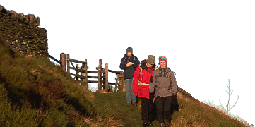
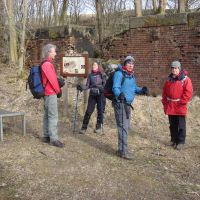
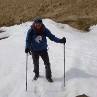
A small group of walkers (Daves D and S, Lucie, Bob and Iain) assembled in Healey Dell Nature Reserve car park on the southern outskirts of Whitworth and set off at 09:45 as planned. Conditions were fine, sunny and still but cold and slightly hazy, and remained so for the rest of the day. Odd patches of snow in sheltered spots on the moors were reminders of this year’s late onset of spring.
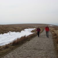
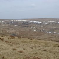
We ascended the cobbled continuation of Station Road past the hamlets of Broadley Fold and Prickshaw, then followed Knacks Lane in the direction of Hunger Hill before turning right to head upwards along the Pennine Bridleway at the Bottom of Rooley Moor. The bridleway led us up over moorland past Pike Brow and Top of Pike; along the way, a lone figure walking quickly to catch us up turned out to be Dave Wylie, who was adding miles to his day’s route by walking from home! The Naden Reservoirs could be seen in the valley westwards, while the turbines of the extensive Scout Moor Wind Farm were visible (indeed difficult to miss) high on the moors to the NW. We continued along the bridleway (following the Rooley Moor ‘Cotton Famine’ Road along well-laid stone setts dating from its improvement apparently in a work creation scheme of the 1860s) past Hamer Hill and eventually took a short detour straight up to the summit and trig point at Top of Leach in time for elevenses.
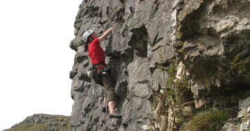
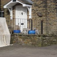
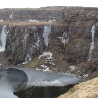
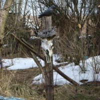
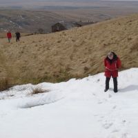
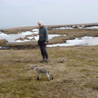
Descending to cross the bridleway once more, we followed paths (including a mountain bike trail with mini jumps) overlooking the Britannia Quarries area and leading us through the Lee Quarries, where some impressive icefalls were still visible and which proved to be especially busy with an organised motocross bike competition, various mountain bikers on trails and even the odd horse rider! We left the noise and bustle of Lee Quarries and headed down paths over farmland towards the relative peace and quiet of Britannia, reaching the main road (A6066) near the New Line mini-reservoir and picnic area. We headed through Britannia for a short distance past the Lancashire Sock works, before turning up Cobden Street and heading up to the northern end of the ridge of hills running east of Whitworth. Paths led us up past Higher Hogshead Farm and beyond, with some interesting garden folk art on the way, and around the southern and eastern slopes of Hogshead Law Hill. We paused beyond the last of the farm buildings and had lunch beside a patch of snow before heading on up to the high moors (where an apparently motherless recently-born lamb took great interest in us) and the trig point at Trough Edge End.
We followed the ridge south over Trough Edge, then over the ominous-sounding Hades Hill and Middle Hill. Amongst the quarries on Middle Hill, we spied another lone figure waiting for us in the distance; this proved to be Chris Thickett who had come out later in the day (following some morning DIY) in the hope of finding us en route. We passed on over Brown Wardle Hill (overlooking Watergrove Reservoir to the east and Whitworth to the west), descending through a large herd of shaggy-looking ponies and then following the Pennine Bridleway to skirt past Lobden Golf Club and Rushy Hill (although Daves S and W here made a quick detour up to the trig point).
We then descended the short last stretch to the main road at Healey, although Dave Wylie headed off just before this on his long walk home. Most of the others headed straight back to the car park, although Daves D and S and Lucie took a moderate detour though Healey Dell Nature Reserve to see Th’Owd Mill I’th Thrutch (twin stone arches spanning the River Spodden, the remnants of a 17th-19th C fulling mill) and the Fairies Chapel (a picturesque water-worn gorge further upstream), and got back to the cars just after 16:00.
Total mileage for the walk was around 13.5 miles as calculated by Dave Wylie, although his own total distance was around 22 miles for the day and close to 40 miles for the weekend!
DaveS
Meet Promo:
This is a circular walk (much of it on good paths including the Pennine Bridleway and Rossendale Way) over hills and moors between Rochdale and Bacup, centred around the small town of Whitworth. There is a little potential route overlap with a walk led in November 2008 by Phil Ramsbottom but otherwise the area appears to have been largely unvisited by club walking meets for some years.
Start point: Healey Dell Nature Reserve car park (grid ref SD 879164), Station Road, Broadley, southern outskirts of Whitworth.
The car park is at the end of (the tarmac section of) Station Road, directly (west) off the main A671 which runs through Whitworth; the entrance to Station Road is marked by a sign on the A671 pointing to a nature reserve (silhouette of a wading bird) and car park. If in doubt please ensure that you are on ‘Station Road, Broadley’ (as indicated by street signs on a house wall at the start of the road) at the south end of Whitworth – to confuse the issue there is another more urban Station Road also west off the A671 a little further north in central Whitworth!
The car park itself is free but relatively small (about a dozen spaces), however additional parking is available on various stretches (including a layby-style section) along Station Road itself.
Start time: Meet at 09:30 for a 09:45 start.
Map: OS Explorer sheet OL21 (South Pennines); alternatively Landranger sheets 109 (Manchester) and (possibly) 103 (Blackburn & Burnley).
Distance: 10-12 miles depending on route, which may vary slightly according to weather and a further planned recce by the meet leader.
Route: Pretty much a grand circuit clockwise around and above Whitworth and the Cowm Reservoir as follows: up moorland over Pike Brow – Top of Pike – Hamer Hill (along Rooley Moor Road) – Top of Leach (optional) – down through Britannia Quarries area – back down to the A671 somewhere between Millgate and Shawforth – up to the ridge east of Whitworth heading possibly for Hades (no, really) or as a shorter alternative more directly up to Brown Wardle Hill and then heading south along the Rossendale Way or Pennine Bridleway, skirting Lobden Golf Club and back down to the cars. Post-walk refreshments available at the Red Lion in Whitworth Square if desired.
DaveS
