Sun 24th Oct, 2010
Berwyn: "Pistyll packing"
Members present: Dave Bone, Laura Collier, Sandy Gregson, Jim Gregson, Koy Oi Ding, Bob Kelly, Dave Shotton.
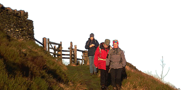
Saturday in the Berwyn was marked by several rainy downpours, but Sunday brought a hard frost and brilliant sunshine with just a small banner of cloud to disperse. The group of connoisseurs listed above strode into Cwm Pennant from Llangynog, serenaded raucously by flocks of pheasants as height was gained. Eventually the underfoot Llwybr Choeddus gave way to Llwybr Disappearus in deep tangled heather hiding water-filled holes. Thankfully this character-building stuff only lasted until the Milltir Garreg road was reached.
 |
| Back into the Sunshine |
From here the going along the main Berwyn crest improved, partially over sleepers, so the pace quickened. The extensive views, from Plumlimon in the south, over all of Snowdonia and out past Clwyd into the Irish Sea then over the Cheshire plain and Shropshire were sparklingly clear. At Cadair Berwyn there was a brisk north-westerly breeze, so after just a short stop the party legged it towards Pistyll Rhaeadr, threading downhill among more people now. A tea stop was shivered through at Tan-y-pistyll below the waterfall, for this valley head was now in deep shade. The waterfall discharging Saturday's rain looked very fine.
The KMC pushed onwards to reascend back into warming sunshine to go over the ridge into the Tanat Valley, where flocks of fieldfares showed more intelligence than the pheasants. We reached Llangynog with plenty of daylight to spare, although all seemed to agree that there had been some tough going during a rewarding walk.
Jim Gregson
Meet Promo:
Another varied walk in a little-visited (by KMC) range of hills to tempt you out for an autumn day a week before the end of British Summer Time.
Maps needed - OS Landranger 125 Bala or Explorer Map 255 Llangollen & Berwyn
Start Point: Car Park (+ pub. convs.) in village of Llangynog at Gr Ref SJ054262. Meet at 0915 for prompt 0930 start.
Due to complex geography, 2 possible approaches to Llangynog in the Tanat Valley:
A) From the E via Wrexham bypass, A483 then A5 to Oswestry. Turn W onto B4580 thru' town then W to Llanrhaeddr-ym-Mochnant. Go uphill on minor road to drop into Tanat Valley at Penybontfawr, turn R and on to Llangynog. From S Manchester allow 1hr 30 minimum for drive. If this looks too complex consider;
B) From the W (final stretch). This involves first going to Corwen, either via Llangollen or Ruthin. From Corwen go on B4401 thru' Cynwyd and Llandrillo then to junction at Gr Ref SH985365. Turn L AND L up very steep lane over hill to join B4391. Turn L and follow SE over Milltir Gerrig Pass then down to Llangynog.
Walk Route --- Leave Llangynog on "Melangell Walk" lane towards Cwm Pennant for 1.5 km. At 039258 turn R onto drive which climbs gently above plantations, heading NW (sometimes visible here - ornamental Reeves Pheasants, exotic birds native to China). Track climbs up thru' Cwm Nantewyn onto moorland of Hafod Hir, and works over to reach road B4391 at Milltir Gerrig 019301. Go NW for 200m then the track to Berwyn leaves on R through heather and hummocks. This track leads NE for approx. 5km - some of it on wire-meshed sleepers - all the way to summit of Moel Sych at 067318. Go 1km NNE to tick trig point on Cadair Berwyn 073327. Backtrack to Moel Sych then leave summit heading S by fence, dropping over Trum Felen to reach edge of wood at 073296 - over stile to get view of top lip of Pistyll Rhaeadr, one of Wales' most impressive waterfalls. Back to stile then down zigzag track to Tan-y-pystill below falls. With luck the cafe will be open. From cafe go to footbridge directly below falls for a closer look, then head SE thru' lower edge of wood below rocky slopes of Craig-y-Mwn. Head up past old workings on tracks leading past another waterfall to cross SW over ridge at 073279 to find track down into Cwm Glan-hafon (big right of way zigzag on map). At 065270 bear R to make final exit from small valley to reduce tarmac finish to a final .5km back to Llangynog. Total distance approx. 23km -- take headtorch if likely to flag!
(If weather on the day is not so favourable the walk can be adjusted by omitting short leg out to Cadair Berwyn, and making more sheltered descent from Moel Sych via Llyn Lluncaws and Nant y Llyn. BUT you are supposed to be mountaineers.)
Croeso! Jim Gregson.
Jim Gregson


