Sun 20th Oct, 2002
Yorkshire Dales Walk
Members present :Jim Gregson, Sandy Gregson, Iain McCallum, Lorna Marsland, Alan Peck, Peter Walker, Frank Williams, Margaret Williams, Keith Williams, Dave Wylie (10)
Guests present: Trish Cranston, Jean Coates, Joan Green, Dave Swindlehurst (4)
The day dawned with leaden skies but the visibility was very good. Rain was forecast for the afternoon.
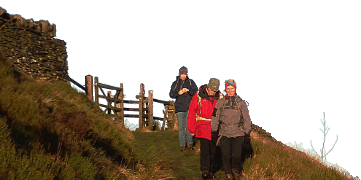
Leaving Twistleton Lane we crossed the footbridge over the river Doe to Scar End and climbed steeply up the hill following the green track up on to the ridge. Eventually we made for the path which follows the wall along the ridge to the summit of Whernside. Along the way we stopped for a break in a sheltered spot before reaching the Trig Point (736m) at about 12.15pm. From the summit we could see the Lakeland hills across Morecambe Bay and the Howgills to the north west. By now the wind from the south east was very strong and we huddleded down for lunch behind the wall - a rather draughty perch!
From the summit we followed the little track down the hillside to the road at Kingsdale Head. Turning towards Dent we tramped along the road until we reached the rough cart-track which winds it way to Dent across the aptly named Foul Moss. At the second bend we left the track, clambered over a wall, and climbed the hill side up to the ridge leading to Green Hill (626m) and Gragareth (627m). By now the clouds had enveloped the tops of Ingleborough and Whernside threatening rain. We made haste to Gragareth and the end of the ridge. Instead of following the ridge Keith lead the party in a rapid descent into Kingsdale just as the rain started at about 3.30pm. Although heavy at first it soon eased off as we followed the Turbary road back to cars where we arrived at 4.30pm. The pub in Thornton was our next port of call for a well earned drink.
Distance about 12 miles.
Thanks for your support.
Iain McCallum
Meet Promo:
This walk combines the two ridges around Kingsdale. The route climbs Whernside following the crest of the ridge to the summit before dropping down to the road at Kingsdale Head. On leaving the road the route follows a track for a short distance and ascends the hillside to the top of Green Hill and then along the ridge to Gragareth before descending into Kingsdale. The walk can easily be extended to take in Great Coum and Crag hill or shortened to just climbing Whernside.
Start/finish: Twistelton Lane, Kingsdale at the junction with the Thornton to Dent road ( GR.692760). Parking is rather limited at this point but it is possible to park alongside the road before reaching Twistleton Lane at GR. 691758 - in or near a lay-by opposite a small quarry.
Route: Twistleton Lane - Scar End- North Green- West Fell - Bruntscar - Whernside (736m) - High Moss - Foul Moss - Green Hill (626m) - Gragareth(627m) - Dodson's Hill - Turbury Road - Twistleton Lane. Distance 12 miles.
Meet at 9.30am for a 9.45am start.
Map - OS Outdoor Leisure 2 Yorkshire Dales - Western Area
Iain McCallum


